Urban Digital Twin
- Home
- Urban Digital Twin
Lorem ipsum dolor sit amet, consectetur
Lorem ipsum dolor sit amet, consectetur adipiscing elit, sed do eiusmod tempor incididunt ut labore et dolore magna aliqua. Ut enim ad minim veniam
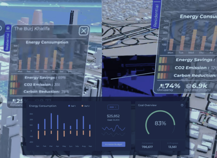
From Spotnik, we present the most accessible and game changing Digital Twin initiative for corporations and governments to drive Sustainability engagement. The platform leverages the best of technology to reflect a holistic EHS data with a set of panels and KPI’s to enhance decision making to achieve environmental targets.
Spotnik Smart City Studio ©
The urban digital twin is a realistic digital 3D representation of the world including cities, communities, assets, infrastructure.
It encompasses also for a given city, the current landscape of buildings, traffic, trees, daylight and shadows, and points of interest.
Powered by holistic data (environmental, operational, geographical, social, and so on), digital twin allows the simulation of the effects of decisions before enacting them in the physical world, thereby opening a new opportunity for smart city, city development planning, sustainability, social impacts, real-time traffics, etc.

What is Urban
Digital twin
The urban digital twin is a realistic digital 3D representation of the world including cities, communities, assets, infrastructure…
It encompasses also for a given city, the current landscape of buildings, traffic, trees, daylight and shadows, and points of interest.
Powered by holistic data (environmental, operational, geographical, social…), digital twin allows the simulation of the effects of decisions before enacting them in the physical world, thereby opening a new opportunity for smart city, city development planning, sustainability, social impacts, real-time traffics, …

Value-Driven Insights
Delivering valuable insights, facilitating visual reporting, and simulations for better planning and forecasting
Platform Ready
Interface with 3rd party (IOT Platform, ERP, MES, External API, …)
Analytics Layer
showcase, monitor & forecast KPIs & deliver tangible information & insights
Data models
Computing multi-sources data (GIS, IOT sensors, BIM, climate files…)
Platform Ready
Interface with 3rd party (IOT Platform, ERP, MES, External API, …)
Analytics Layer
showcase, monitor & forecast KPIs & deliver tangible information & insights
Data models
Computing multi-sources data (GIS, IOT sensors, BIM, climate files…)

3D
Realistic model of city
GIS
Integration with Geographic information system mapping
Trading Systems
lorm

3D
Realistic model of city
GIS
Integration with Geographic information system mapping
We Organize Our
Production Process
- Benchmark
- Simulation
- Explore
Compare different timeline situations of different assets (cities, communities, infrastructure) based on historical data to show up relevant KPIs to lean better strategic decisions to achieve environmental targets.
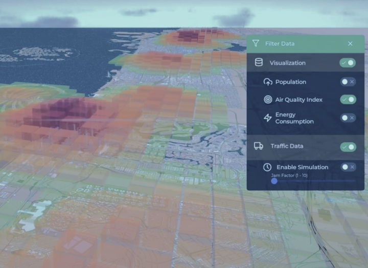
Simulate different scenarios with interactive data and AI Powered features to help monitoring, strategic decision making and visualization of the impact of projects before realization.
Move across a digital twin city with a different camera view (City/ district/ community/ building/ assets) and visualize live customized KPIs

Advanced Features
Move across a digital twin city with a different camera view (City/ district/ community/ building/ assets) and visualize live customized KPIs
LEARN MOREExplore
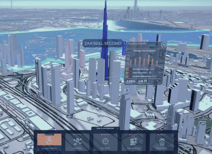
Simulate different scenarios with interactive data and AI Powered features to help monitoring, strategic decision making and visualization of the impact of projects before realization.
LEARN MORESimulation
Compare different timeline situations of different assets (cities, communities, infrastructure) based on historical data to show up relevant KPIs to lean better strategic decisions to achieve environmental targets.
LEARN MOREBenchmark
